Guizhou Province, China
I spent 10 months of 2014 with a Fulbright grant conducting fieldwork in Guizhou, in southwest China. The goal of this research was to gain information about the geographic, social, and natural resource conditions of the villages and about village governance. This fieldwork provides the data used in my dissertation.
I did most of my research in Shi Bing county, in eastern Guizhou. I focused on two townships: Bai Duo township, near the county seat of Shi Bing, and Ma Hao township. I also did some research in Sha Ping township, Zhen Feng county, in the southwest of Guizhou.
This page provides a brief overview of my main research sites, including pictures and observations from my experiences there. I’ve also written about the research process for the Field Research Method Lab of London School of Economics. Please contact me if you are interesting in any of these pictures.
|
karst Landscape
Guizhou is part of one of the largest karst areas in the world. The South China Karst belt covers an area of 550,000 square kilometers as the land drops from the mountains of Tibet to the low altitudes of Guangxi.
Karst areas pose unique water management problems because water tends to flow into underground rivers and inaccessible aquifers, meaning that rainfall doesn’t necessarily translate into usable water. In 2014, the area of Yun Tai Shan in Shi Bing county was designated a UNESCO World Heritage site. |
|
Infrastructure
Guizhou is in the process of developing its transportation system. There is construction everywhere.
The roads within villages are almost all paved, but roads accessing villages often are still dirt. In Ma Hao township, the main road to many of the villages is supposed to be paved only after there are no more trucks and equipment going to a construction site for a high speed rail that will cross the township. Even when roads are built, however, they’re often too narrow or quickly need repairs. |
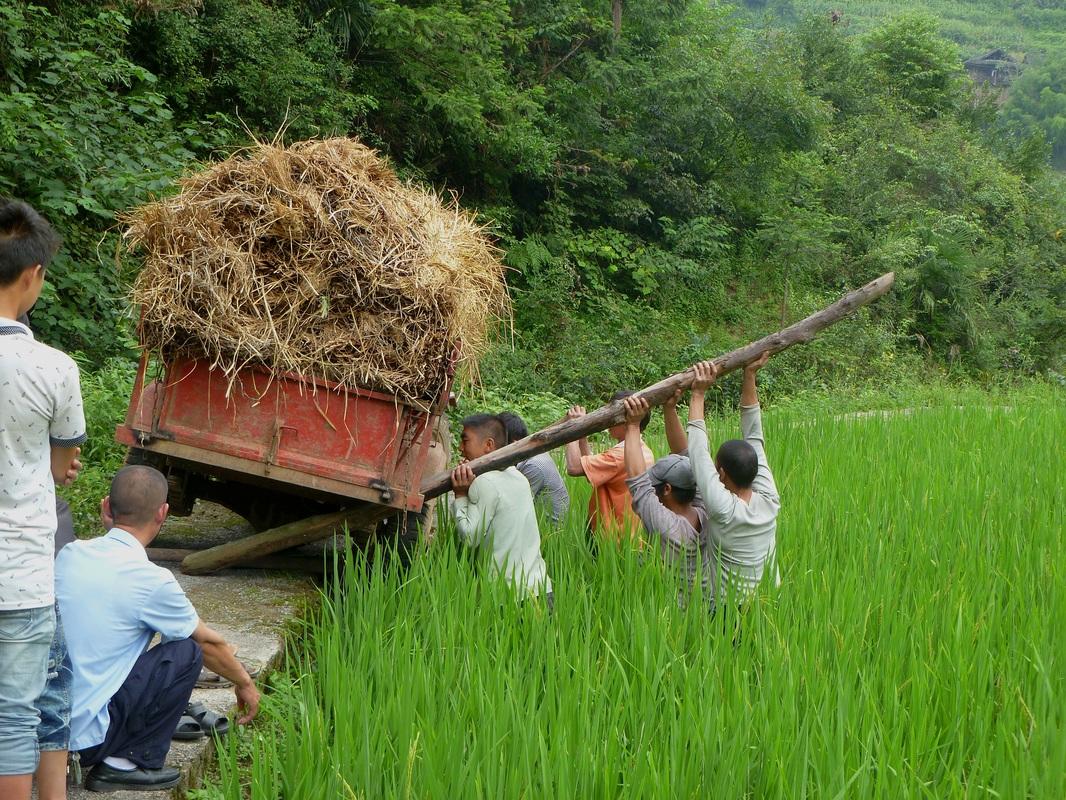
This road through the rice paddies is a little too narrow, even for such a small truck.
|
Drinking water
At first glance, Guizhou Province is not water scarce. Rainfall is far more plentiful than in the north of China and there are many rivers. Most of the annual rainfall is between May and August. During this time, rain replenishes aquifers and the rivers are full. However, in karst areas, rainwater flows into underground streams that are often inaccessible from the surface and drain relatively quickly. Because of this, managing water resources – collecting water in the rainy season and carefully allotting it throughout the dry season – is especially important and especially challenging.
Many of the villages in this area access drinking water from springs fed by the underground rivers and aquifers. Some springs gush in the rainy season and are dry by December. Construction can easily disrupt underground rivers and cause springs that were reliable for decades to go dry.
Many of the villages in this area access drinking water from springs fed by the underground rivers and aquifers. Some springs gush in the rainy season and are dry by December. Construction can easily disrupt underground rivers and cause springs that were reliable for decades to go dry.
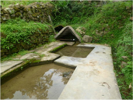
This is a spring in Cha Yuan village. Residents can get drinking water out of the covered part of the spring, where the source is and the water is the cleanest. The water then flows into two pools - the first for washing vegetables and the second for washing clothes - before flowing down the mountain.
|
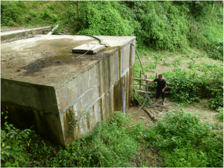
This is the water tank in Bing Dong village. It obviously leaks. The water source was also disrupted by the construction of the nearby high speed train, so there is no longer enough water to provide to the whole village every day.
|
agriculture
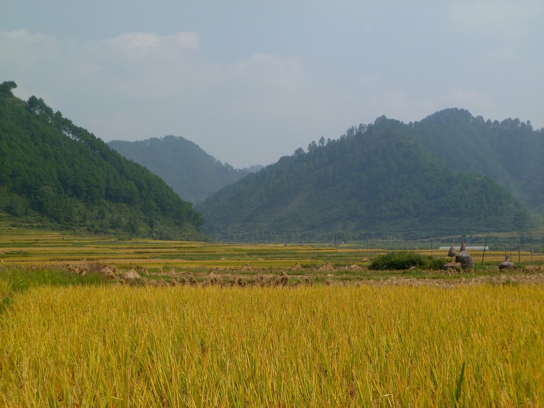
Rice fields ready for harvest
Ma Hao township, Shi Bing county.
|
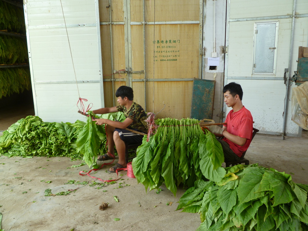
Tobacco being bundled and tied to dry.
Bai Duo township, Shi Bing county.
|
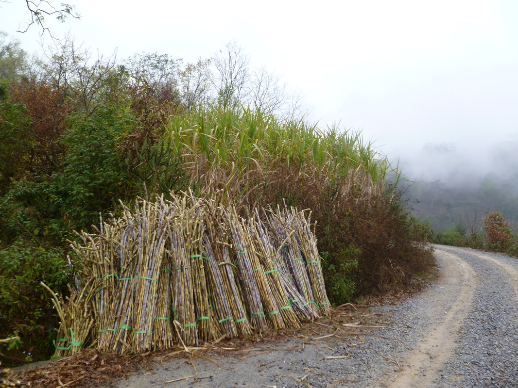
Sugar Cane cut and tied and ready to go to market. Sha Ping township, Zhen Feng county.
|
The landscape in Guizhou is dominated by mountains and then more mountains. This means that the conditions for agriculture in each village are different as the altitude, amount of flat land, and water access vary. In Ma Hao township, most villages grow rice and only one village can successfully grow tobacco. Most of the villages in Bai Duo are able to grow tobacco. Tobacco is much more profitable than rice, so these villages tend to be wealthier. Sha Ping township in Zhen Feng county has more sugar cane and corn.
education
Many of the villages have their own primary school. Middle school and high school students mainly go to either the county seat or as far away as Kaili, the prefecture capital. There are dorms in many of the schools - even the primary schools - for the children who live too far away and more dorms are under construction.
|
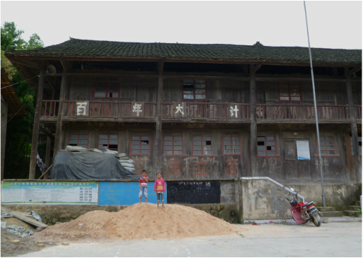
Tang Tou villages is on the northern edge of the Yun Tai Shan protected area in Shi Bing county. While the government is closing most schools that have fewer than 100 students, this one, with only 8, still survives. These kids are playing in the construction materials stored on the basketball court in front of the school.
|
People
More than a third of the population of Guizhou is made up of ethnic minorities. Both Zhen Feng and Shi Bing counties have mixed populations. The population of Sha Ping township is both Han and Bouyi minority group. In Shi Bing county, Bai Duo is almost entirely Han while Ma Hao is almost entirely Miao (Hmong) minority.
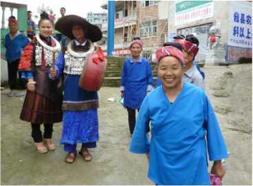 Hmong (Miao) villagers near Shi Dong getting ready for the dragon boat festival. Hmong (Miao) villagers near Shi Dong getting ready for the dragon boat festival.
|
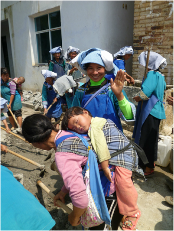
Bouyi women working to build a path through their village. Every household in this village contributed labor, so no one specialized in childcare.
|
fieldwork
During my time in Guizhou, I have had the pleasure of working with researchers at the Shi Dong Hmong Research Center and at the Guizhou Normal University Karst Research Institute. I am extremely grateful for their support, insights, advice, and friendship.
Elise Pizzi © 2014 All Rights Reserved
